
.svg)
Series B will take HEO’s imaging network into GEO for the first time, giving greater visibility into some of the world’s most valuable space assets and advancing the company’s ambition to make imagery of any object in the solar system available on demand.
.png)
SYDNEY, AUSTRALIA [September 21, 2026] - HEO, a space intelligence company that uses satellites to photograph and analyse other objects in space, has raised US$25 million in Series B funding to expand its network into geostationary orbit.
The round was led by Beaten Zone Venture Partners, with participation from Australia’s National Reconstruction Fund, Dcode Capital and existing investors Airtree and Salus Ventures.
HEO’s ambition is to make imagery of any object in the solar system available on demand. It currently operates the world’s largest commercial Non-Earth Imaging network, with access to more than 50 sensors in orbit.
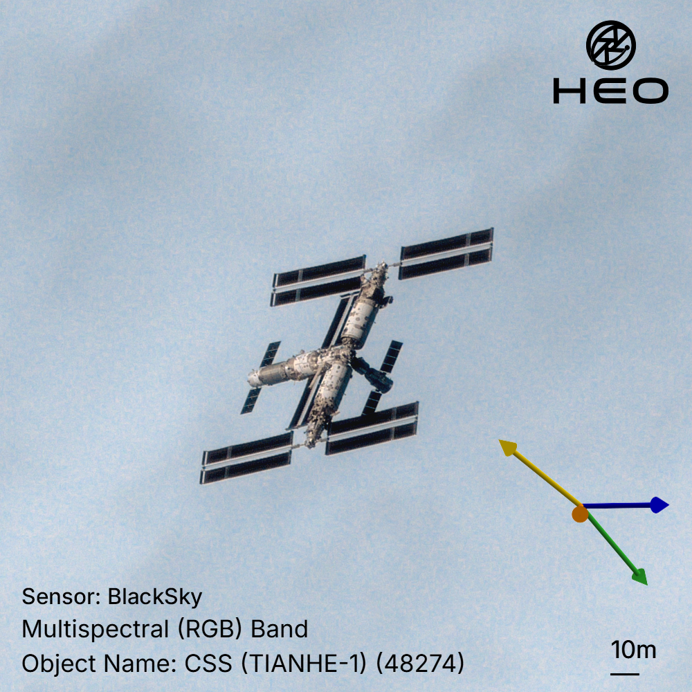
Thousands of spacecraft now operate across increasingly congested orbits, performing complex manoeuvres, interacting with other assets and supporting critical infrastructure on Earth. Traditional monitoring systems largely answer one question: where is an object? Modern space operations require a deeper understanding of what that object is, what condition it is in, what it may be doing and what action an operator should take.
The new funding will accelerate HEO’s expansion into geostationary orbit, or GEO, where many of the world’s most valuable telecommunications, weather and national-security satellites operate, but commercially available imagery of spacecraft remains extremely limited.
HEO has booked its first two GEO launches, beginning later this year, and plans to establish reliable, repeatable GEO imaging coverage in 2027. The funding will support new sensor deployments, expanded partnerships with satellite operators and continued development of the software and AI models used to turn orbital imagery into actionable intelligence.
“Some of the world’s most critical infrastructure is operating tens of thousands of kilometres above Earth, but our ability to see and understand what is happening to it remains limited,” said Dr William Crowe, CEO and Co-Founder of HEO. “This funding allows us to extend our network into GEO and bring us closer to a future where governments and satellite operators can inspect any object in space when they need to.”
HEO combines imagery from cameras aboard existing Earth-observation satellites with data from its own proprietary sensors. Its autonomous software identifies imaging opportunities, tasks satellites, processes the resulting imagery and applies AI-powered analysis to deliver decision-ready intelligence about spacecraft and other objects in orbit.
Steve Baxter, founder & lead investor, Beaten Zone Venture Partners, said: "HEO has created a new data type for space domain awareness, at a time when the number of space objects is growing exponentially. Expanding to GEO makes them the first mover in a validated government demand market and will unlock further capabilities for their expanding customer base. We believe they are on track to become one of Australia's most important defence industry unicorns.”
NRFC CEO David Gall said, “Space is an increasingly contested and complex environment of great strategic importance to Australia’s national security. The NRFC’s investment will enable HEO to monitor 90 per cent of space objects of interest to Australian and allied defence and intelligence agencies, shoring up a critical sovereign defence capability for the nation.”
Since its $8 million Series A in 2023, HEO has:
As servicing, inspection, defence and autonomous missions become more common, satellite operators will need timely visual intelligence about the condition and behaviour of the objects around them before making critical decisions.
HEO ultimately intends to build an intelligence layer spanning low-Earth orbit, geostationary orbit and beyond, allowing governments and commercial operators to understand and act on what is happening in space.
About HEO
HEO is building the intelligence layer for space. We image objects in orbit on demand, turning existing satellites into inspection platforms and building our own sensors where coverage gaps remain. Our software automates tasking, capture and analysis, turning imagery into decision-ready intelligence about satellites, debris and other objects in orbit. HEO operates internationally, with offices in Australia, France, Japan, the United Kingdom and the United States. Our goal is to make any image in the Solar System available on demand.
Media contact:
Dane Brumm
