HEO INSPECT

HEO Inspect 3.0 is the web app and API interface to HEO's core non-Earth imaging and insights. It lets users explore our existing catalogue, task and assess imaging feasibility in realtime, initiate captures, and retrieve imagery and insights at scale. All without switching tabs.
Explore HEO Inspect

HEO inspect 3.0

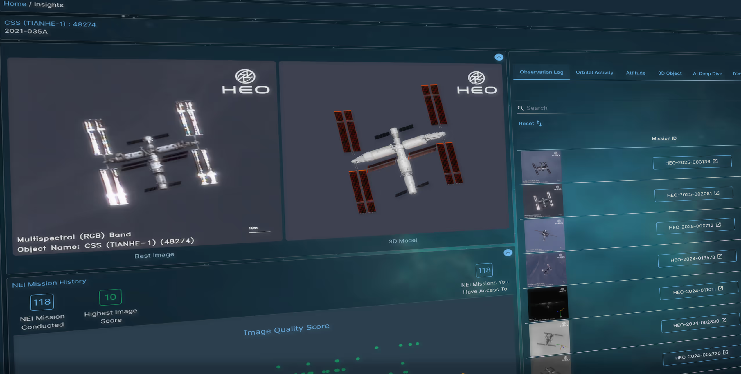
HEO Inspect is the web and API interface to HEO’s NEI software, Tessera, allowing users to explore HEO's existing NEI catalogue and task in-orbit sensors for new image collection. It provides rapid access to NEI data and detailed insights reports, helping you to analyse and understand space objects for various mission needs. All on a unified platform.

Create your free account today
Screenshot from HEO Inspect
EXPLORE

Explore HEO’s past non-Earth imagery and insights, sensor coverage, and upcoming imaging opportunities. Decide when to collect new data to support your mission.

Screenshot from HEO Inspect
TASK

Task HEO’s distributed in-orbit camera network to capture resolved imagery of space objects of interest at scale.

Screenshot from HEO Inspect
ANALYSE

Use proprietary tools to analyse HEO’s NEI data and reports to gain insights into identification, capability and pattern-of-life of space objects.

Bringing together the largest Commercial NEI Network

Use Cases

HEO NEI of XJY
Threat Assessment
Gain persistent visibility on high value spacecraft and fleets. Track behaviour over time to surface emerging risks.
Satellite image
Anomaly Resolution & Attribution
Identify irregularities or anomalies and link them to likely root causes through repeat, multi angle imaging.
HEO NEI of Starlink
Satellite Commissioning
Verify orientation, deployment events, and early spacecraft health. Reduce uncertainty during critical first orbits.
HEO NEI of ISS
Rendezvous & Proximity Operations
Complement RPO missions with independent imagery to assess targets before approach and obtain visual insight during the manoeuvre.

From Imagery to Insights

/001

Identification & Characterisation

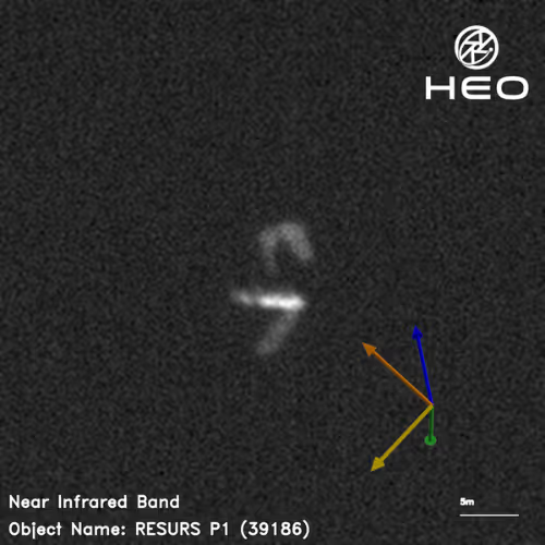
Visual detection rapidly identifies new objects and payloads from launch or debris events and determines space object classification.

HEO Non-Earth Imagery of a satellite
/002

Attitude Estimation & Tumble Rate

Understand where a payload is pointing, where the solar panels are facing, and if a satellite is tumbling to see how a space object is operating in orbit.

HEO 3D model of Landsat, based on Non-Earth Imagery
/003

3D Modelling

In-orbit imagery and open-source data help us construct realistic 3D models of objects, providing new insights.

HEO generated 3D model of a satellite, based on Non-Earth Imagery
/004

Mensuration

In-orbit imagery from various angles offers accurate mensuration to determine the size, shape, geometry, configuration, and power estimation of a space object.

Annotated HEO Non-Earth Imagery of a satellite