
.svg)
.png)
At HEO, our mission is clear: to image anything in the solar system on demand. A lot of people say space is hard. We would say that we are information poor and that is what HEO is here to solve.
During our 4th annual product event, “T-Minus 4.0”, we highlighted our current progress in non-Earth imaging and the necessary technology we are developing to make space transparent. Read along to see how we are building the information layer for space.
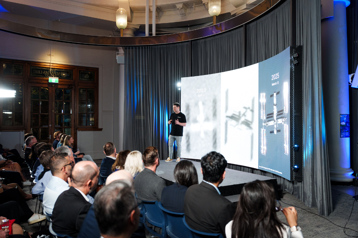
Every year, our image quality gets sharper. By combining advanced software techniques with new sensors, we’re capturing more detail on the space objects our customers care about most.
For instance, take the Chinese Space Station. Three years ago, we could see its shape. Today, we can see its structure, the direction of its solar panels, the texture of its materials, the robotic arm, and we can almost make out the writing.
Through partnerships that position our cameras and partner satellites closer to target orbits and with advanced imaging modes, we’re extracting more meaning from every pixel.
Sharper images are only the start. Our new 3D workflow turns multiple 2D images into realistic models of satellites and spacecraft. Some objects are well documented. Others are misrepresented or missing from public catalogues.
By imaging them from multiple angles using our dispersed network, we start with rough outlines and gradually uncover payloads, structure, and design. When gaps appear, we cross-reference with public data to create the most accurate representation possible. The result is a living model of what’s actually in orbit.

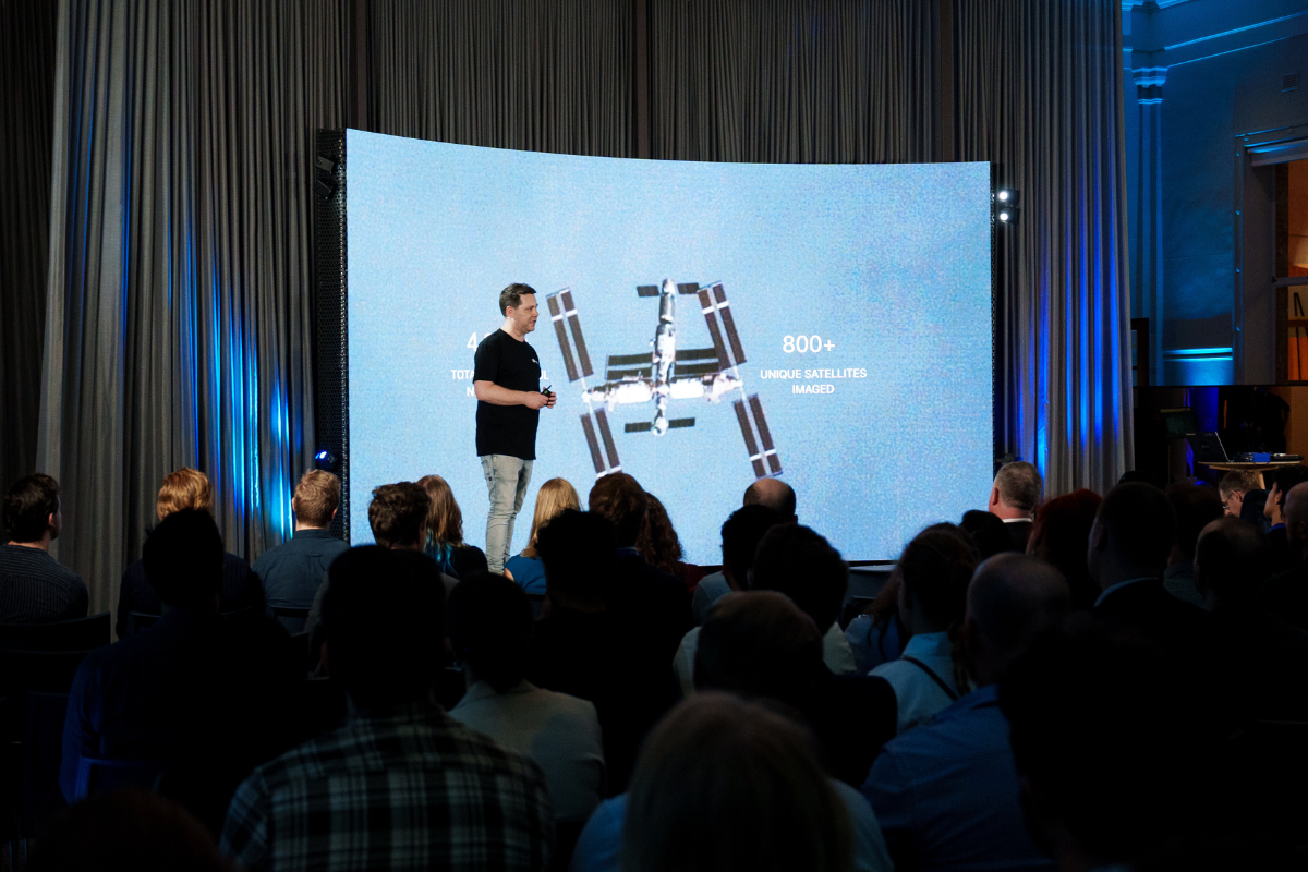
Being close to our customers’ satellites is critical. In 2022, we could fulfil only 5% of Low-Earth Orbit (LEO) imaging requests. Today, thanks to new partners and software innovations, we cover 40%.
Coverage is measured by the percentage of customer requests we can satisfy and every increase means faster tasking, more frequent imaging, and deeper insights.
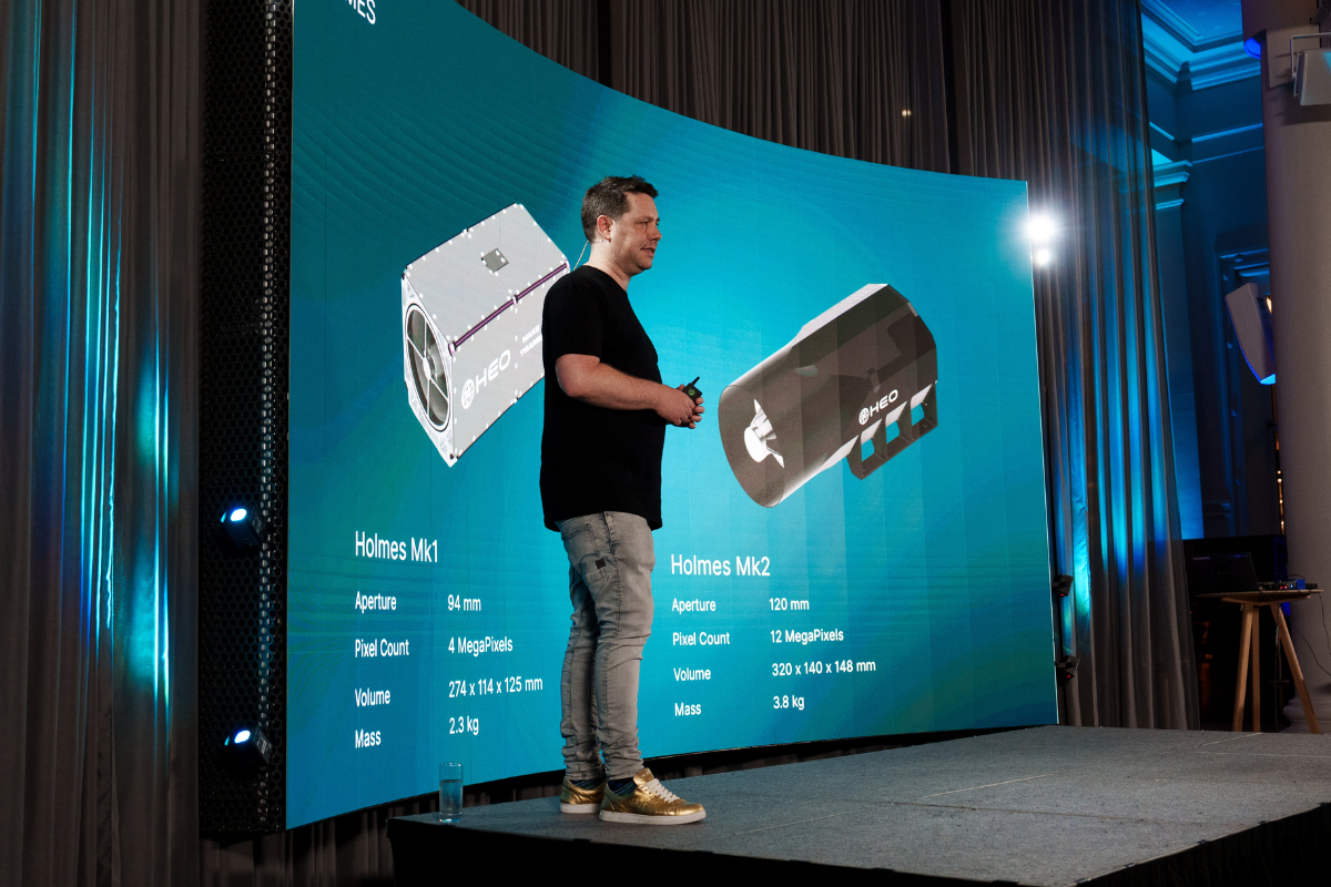
There aren’t enough space-grade cameras being built today, so we started building our own. Designed and manufactured in Australia, the Holmes series lets us move fast, learn quickly, and fill critical gaps in orbit.
With six Holmes Mk1 cameras already in space, we’ve taken those lessons into our next generation: Holmes Mk2. Built to be radiation-tolerant with a five-year design life, it extends our reach into higher orbits like high-LEO. By improving image quality and expanding coverage, Holmes Mk2 will enable us to serve up to 50% more LEO customer requests. Its first mission launches soon with Impulse Space.

Adler Mk2 is our second-generation imager built for distant and demanding orbits. Every component is redesigned to survive a minimum of five years in GEO, where few cameras operate.
Adler Mk2 introduces major upgrades: a new optical system, colour imaging, onboard edge computing for real-time detection, and 100fps capture for short video. With GEO-optimised performance, it extends our mission to place advanced cameras on as many vehicles as possible, meeting a growing demand for eyes in deep orbit.

We’re expanding beyond low-Earth orbit into GEO. This is a region critical to global communications and defence, yet one of the hardest to see from Earth. Every customer has asked us to get there, and now we are.
Our GEO missions will operate in slip orbits, gradually drifting to image the entire GEO belt. We’ll work alongside partners to maintain broad situational awareness. When needed, we can shift into patrol orbits to monitor specific 30-degree sections, or manoeuvre into co-orbital positions for close inspection.
We head to GEO in 2026, with services going live in early 2027. Customers can secure their place in our operations now to be part of the first wave of GEO transparency.
For fifty years, high-resolution satellite-to-satellite imaging was reserved for the world’s largest government agencies. That’s changing as Non-Earth Imaging is now available to the commercial sector.
As satellite constellations multiply, the old model of discarding failed spacecraft no longer makes sense. Commercial operators are beginning to use our imagery to inspect and diagnose their assets. This is the start of the future we envision where we treat satellites like the fleets we manage on Earth. We don’t throw away planes or ships when something breaks. We inspect, repair, and return them to service.
HEO’s technology makes that possible in space. Today our images help teams detect issues like undeployed solar panels, identify if a satellite is in safe mode, measure rotation rates to de-tumble, and update satellite operations in real time. The tools today will help us move from disposal to maintenance and build a sustainable future in orbit.
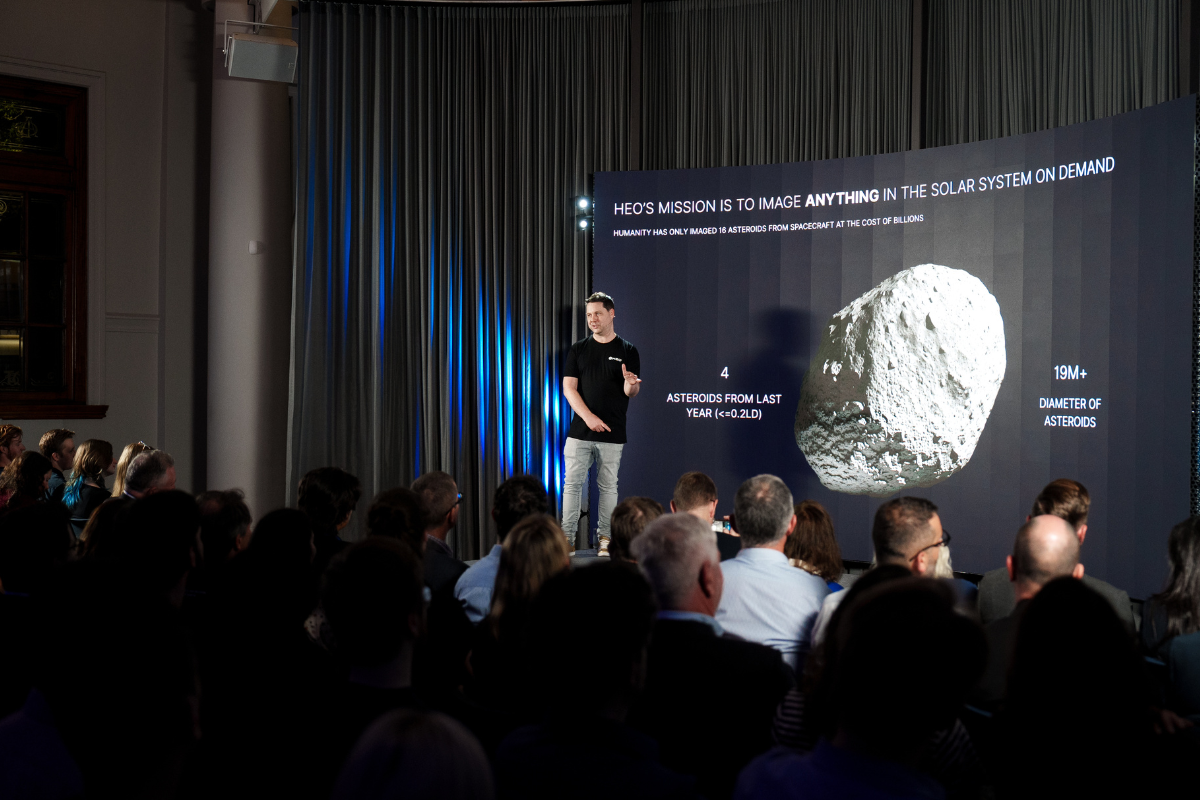
When we say image anything in the solar system on demand, we mean it. Asteroids have been our intention at HEO for years. In human history, only sixteen have ever been imaged by spacecraft. The pace and price no longer fit the reality of discovery.
We’re building a new path forward. When GEO satellites reach the end of their service life, we plan to repurpose their remaining fuel to perform asteroid flybys, capturing detailed imagery and characterising their composition.
Our first step will begin with Apophis in 2029, marking the start of affordable, on-demand asteroid imaging for a new era of planetary awareness.
Every advancement we shared at T-Minus 4.0 moves us closer to a single goal of making space transparent. From sharper imagery to 3D models, from new cameras in LEO to future missions in GEO and beyond, we’re building the information layer for space.
This is just the beginning. Watch the full T-Minus 4.0 keynote to see how we’re shaping the next era of in-orbit intelligence.