Non-Earth Imaging for Satellite Operations
Satellite operations are high-stakes by design. Every mission represents years of work and significant investment. As satellite constellations grow larger and more complex, operators face unprecedented challenges in maintaining situational awareness across their space assets.
Traditional telemetry and ground-based tracking provide essential data, but they can't tell the complete story. When anomalies occur, when deployments don't proceed as planned, or when satellites exhibit unexpected behavior, operators need eyes in space to understand what's really happening beyond Earth's atmosphere.
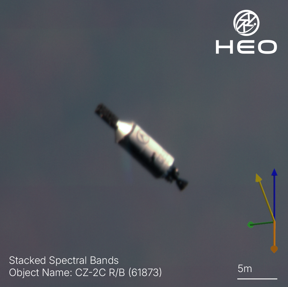
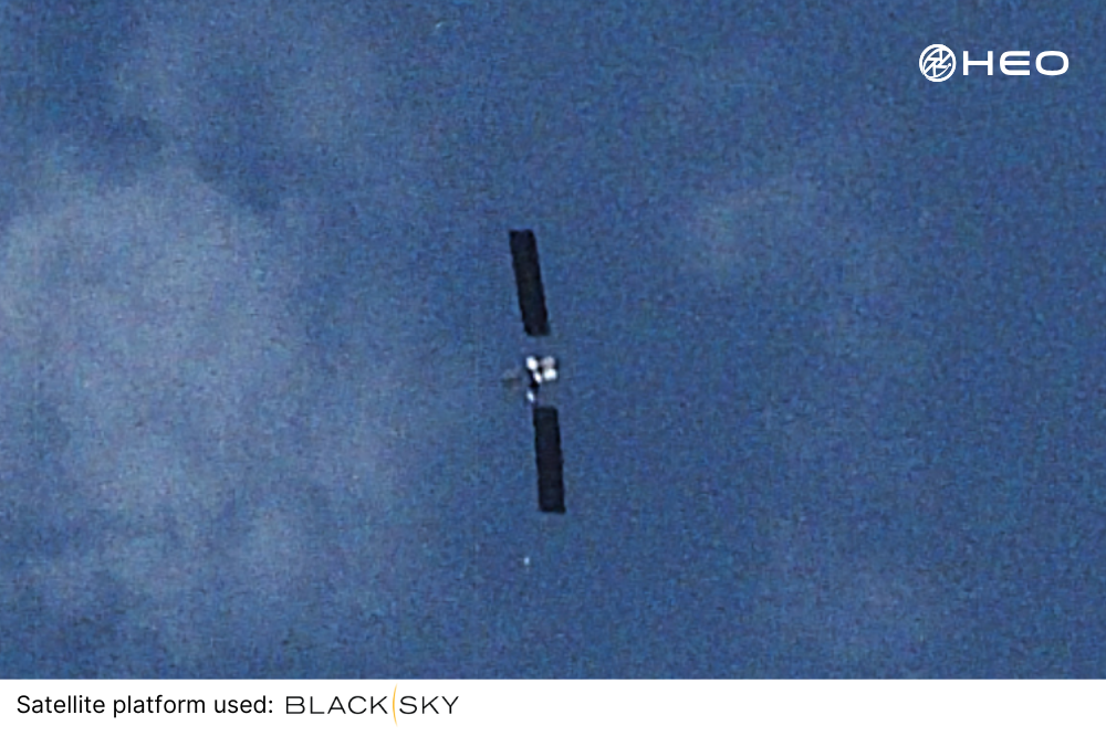
Non-Earth Imaging (NEI) bridges this critical gap. It gives operators resolved, space-based imagery of satellites in orbit that transforms how missions are managed, problems are diagnosed, and fleets are maintained. From the crucial moments following launch separation to ongoing constellation health monitoring and de-risking end of life, NEI offers the visual certainty that is becoming a requirement for space operations today.
The Blind Spots in Satellite Operations
Satellite operators face blind spots that legacy systems were never designed to solve, leaving billions of dollars in space assets at risk. Ground-based tracking remains essential, but it cannot tell operators what is happening on the spacecraft itself. The result is a persistent gap in awareness, from the moment of launch through to end of life.
That gap is most visible during launch and early operations. As soon as a satellite separates from its launch vehicle, operators enter a blackout period. The spacecraft must power up, deploy solar panels and antennas, activate subsystems, and stabilise its attitude before it can make contact with the ground. If anything goes wrong, teams may wait hours for a signal while orbit predictions degrade and sensors lose track. Critical anomalies can go undetected, or worse, operators may assume success while a satellite tumbles uncontrolled.
The truth is that this blind spot does not end after commissioning. Satellites remain vulnerable throughout their operational life. Panels degrade, subsystems fail, objects collide, and anomalies emerge without warning. Without direct visibility, operators are left to infer health from limited telemetry or wait until failures become irreversible. What is needed is a way to see the spacecraft itself, on demand, at any point in its mission.
Telemetry Limitations in Modern Operations
Telemetry reports system status. It tells operators whether a satellite is generating power, maintaining comms, running software. But it doesn’t show what the satellite looks like.
That leaves several unknowns:
- Are solar panels fully deployed and sun-facing?
- Have antennas cleared their restraints?
- Is the satellite damaged or tumbling?
These limitations become particularly problematic as satellite constellations grow in size and complexity, making manual oversight increasingly challenging and error-prone.
How Non-Earth Imaging Supports Satellite Operations
HEO’s NEI system uses a network of 40+ sensors hosted on spacecraft in a range of orbits as of August 2025. These sensors image other satellites during naturally occurring flybys without the need for complex rendezvous and proximity operations maneuvers. This approach delivers scalable coverage that grows with your constellation. Our architecture delivers the high volume of data necessary for persistent monitoring, ensuring operators maintain full situational awareness even across large satellite networks. The result is a real-time visual record of satellite condition and behaviour, from cradle to grave.
Use Cases That Make A Difference
Early Operations Support
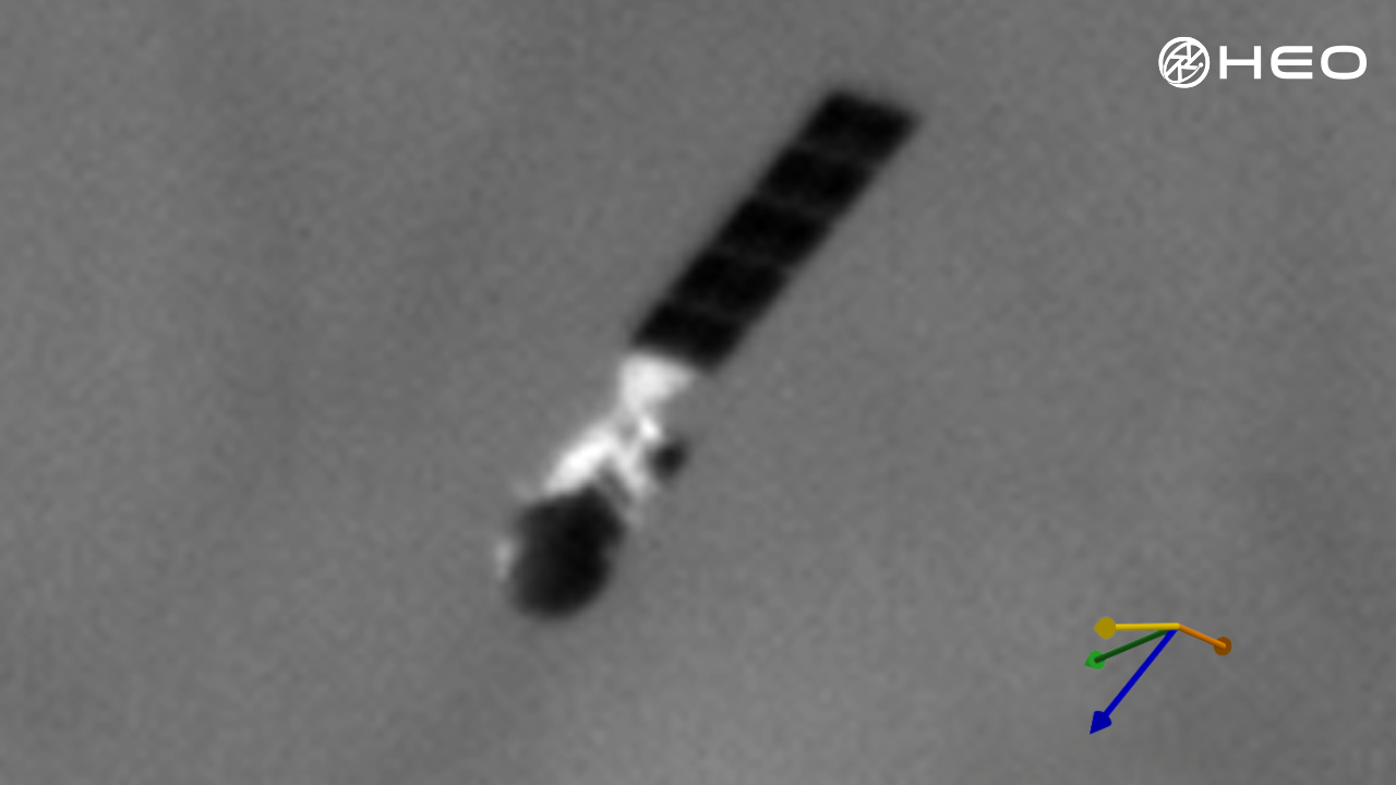
The most critical application of NEI for satellite operators lies in those crucial early moments following launch when satellites are most vulnerable. Visual verification during early operations phases significantly reduces mission risks and provides immediate confirmation of successful deployment.
Post-Launch Deployment Verification: NEI delivers visual verification of a satellite’s identity and correct orientation in orbit. This eliminates the dangerous uncertainty for operators, confirming which satellite is theirs and deployment success.
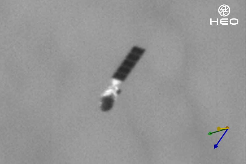
Payload Orientation Confirmation: Resolved imagery reveals the actual physical configuration of newly deployed satellites, confirming that solar panels have deployed correctly, antennas are properly oriented, and payload instruments are positioned as designed.
Early Anomaly Detection: NEI identifies problems such as satellite tumbling, unstable attitude behavior, or deployment failures that might not be apparent from initial telemetry data. Early detection enables rapid response and potential correction before problems become mission-threatening.
Risk Mitigation: Visual confirmation during early operations reduces misidentification risks and provides operators with the confidence to proceed with mission timelines. Rather than operating with uncertainty about satellite status, operators can make informed decisions based on actual visual evidence of satellite condition.
Rapid Anomaly Detection
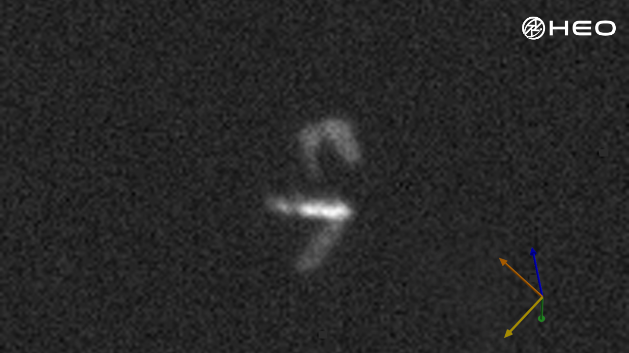
When satellites experience problems, time is critical. Traditional telemetry systems can indicate something is wrong but often cannot reveal the nature or severity of the problem.
Visual Problem Diagnosis: When telemetry indicates anomalies, NEI provides visual confirmation of satellite status, helping operators identify issues before it’s too late.
Mission Degradation Prevention: Early visual detection of developing problems enables proactive responses that prevent minor issues from escalating into mission-threatening failures.
Verification of Corrective Actions: After implementing corrective measures, NEI provides visual confirmation that interventions have been successful, enabling operators to verify problem resolution rather than relying solely on telemetry normalisation.
Insurance and Liability Support: Visual documentation of satellite condition supports insurance claims and liability determinations, providing objective evidence that complements telemetry records.
Constellation Monitoring
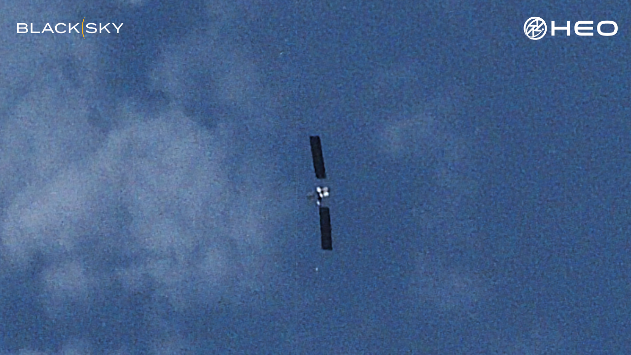
As satellite constellations grow to include hundreds or thousands of satellites, traditional manual oversight becomes impossible. NEI provides the scalable monitoring capabilities necessary for effective fleet management across large satellite networks.
Persistent Fleet Oversight: HEO's distributed sensor network enables continuous monitoring across entire constellations, providing regular visual updates on satellite health without requiring dedicated oversight resources for each satellite.
Automated Health Assessment: Regular imaging from multiple angles enables automated assessment of satellite health and configuration, identifying satellites that require attention while allowing operators to focus resources on priority issues.
Performance Verification: Visual monitoring confirms that satellites maintain proper orientation, that deployable components remain correctly positioned, and that overall satellite configuration matches operational requirements throughout mission lifecycles.
Operational Anomaly Detection: Constellation-wide monitoring enables detection of patterns or systematic issues affecting multiple satellites, supporting proactive fleet management and preventive maintenance strategies.
Scalable Service Delivery: HEO's on-demand service model scales with constellation size, providing cost-effective monitoring that grows with fleet expansion without requiring proportional increases in ground-based monitoring infrastructure.
The HEO Advantage for Satellite Operations
Proven Operational Experience
HEO has successfully monitored satellites across various orbital regimes, providing visual intelligence that has supported mission-critical decisions for satellite operators worldwide. Our track record includes early identification of deployment anomalies, rapid diagnosis of operational problems, and persistent monitoring across diverse satellite constellations.
Multi-Perspective Insights
Our distributed sensor architecture enables imaging from multiple angles throughout orbital periods, providing comprehensive views of satellite configuration that single-perspective monitoring cannot achieve.
Non-Invasive Monitoring
HEO's flyby methodology enables monitoring without requiring satellites to deviate from operational orbits or perform proximity operations that could introduce additional risks. This approach maintains operational security while providing essential visual intelligence.
Scalable Coverage
Our sensor network scales with constellation requirements, providing cost-effective monitoring that grows with fleet expansion. The distributed architecture ensures persistent coverage without single points of failure that could compromise monitoring capabilities.
Conclusion
Satellite operations represent massive investments and critical infrastructure, making visual insights through Non-Earth Imaging a strategic advantage. In the unforgiving environment of space, where minutes can mean the difference between saving a mission and losing a satellite forever, operators face a race against the clock with every anomaly and deployment. Traditional monitoring approaches create dangerous blind spots, from the critical post-launch period that leaves newly launched satellites untracked to telemetry-only health monitoring that can't reveal the true nature of problems threatening mission success.
HEO's NEI capabilities eliminate these blind spots and transform mission management. From post-launch verification to persistent constellation monitoring, NEI provides visual insights that gives operators a strategic edge in satellite operations.
As constellations scale, gaps in awareness multiply. Non-Earth Imaging gives operators the visual clarity to manage complexity, reduce risk, and move with confidence.